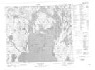
Maps showing Hudson Bay Point, Saskatchewan
Hudson Bay Point is a Cape located in Saskatchewan.
- Latitude: 54° 38' North (decimal: 54.6333946)
- Longitude: 102° 18' West (decimal: -102.3004061)
- Topography Feature Category: Cape
- Geographical Feature: Point
- Canadian Province/Territory: Saskatchewan
- Atlas of Canada Locator Map: Hudson Bay Point
- GPS Coordinate Locator Map: Hudson Bay Point Lat/Long
Hudson Bay Point NTS Map Sheets