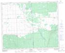
Maps showing Dillabough, 23-41-6-W2, Saskatchewan
Dillabough is a Unincorporated area located in 23-41-6-W2, Saskatchewan and has an elevation of 455 meters.
- Latitude: 52° 33' North (decimal: 52.5500013)
- Longitude: 102° 46' West (decimal: -102.7671382)
- Topography Feature Category: Unincorporated area
- Geographical Feature: Hamlet
- Canadian Province/Territory: Saskatchewan
- Elevation: 455 meters
- Location: 23-41-6-W2
- Atlas of Canada Locator Map: Dillabough
- GPS Coordinate Locator Map: Dillabough Lat/Long