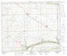
Maps showing Lone Rock, 15-47-27-W3, Saskatchewan
Lone Rock is a Hamlet located in 15-47-27-W3, Saskatchewan and has an elevation of 636 meters.
- Latitude: 53° 3' 00'' North (decimal: 53.0499722)
- Longitude: 109° 52' 44'' West (decimal: -109.8788749)
- Topography Feature Category: Hamlet
- Geographical Feature: Organized Hamlet
- Canadian Province/Territory: Saskatchewan
- Elevation: 636 meters
- Location: 15-47-27-W3
- Atlas of Canada Locator Map: Lone Rock
- GPS Coordinate Locator Map: Lone Rock Lat/Long
Lone Rock NTS Map Sheets