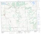
Maps showing Longhope, 27-50-18-W3, Saskatchewan
Longhope is a Unincorporated area located in 27-50-18-W3, Saskatchewan and has an elevation of 669 meters.
- Latitude: 53° 20' North (decimal: 53.3334192)
- Longitude: 108° 34' West (decimal: -108.5673572)
- Topography Feature Category: Unincorporated area
- Geographical Feature: Locality
- Canadian Province/Territory: Saskatchewan
- Elevation: 669 meters
- Location: 27-50-18-W3
- Atlas of Canada Locator Map: Longhope
- GPS Coordinate Locator Map: Longhope Lat/Long
Longhope NTS Map Sheets