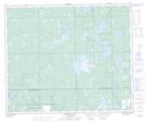
Maps showing Lookout Hill, 20,28,29-57-25-W3, Saskatchewan
Lookout Hill is a Mountain located in 20,28,29-57-25-W3, Saskatchewan and has an elevation of 639 meters.
- Latitude: 53° 57' North (decimal: 53.9500967)
- Longitude: 109° 41' West (decimal: -109.6841046)
- Topography Feature Category: Mountain
- Geographical Feature: Hill
- Canadian Province/Territory: Saskatchewan
- Elevation: 639 meters
- Location: 20,28,29-57-25-W3
- Atlas of Canada Locator Map: Lookout Hill
- GPS Coordinate Locator Map: Lookout Hill Lat/Long
Lookout Hill NTS Map Sheets