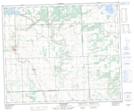
Maps showing Dulwich, 34-49-20-W3, Saskatchewan
Dulwich is a Unincorporated area located in 34-49-20-W3, Saskatchewan and has an elevation of 555 meters.
- Latitude: 53° 16' North (decimal: 53.2667516)
- Longitude: 108° 50' West (decimal: -108.8340446)
- Topography Feature Category: Unincorporated area
- Geographical Feature: Railway Point
- Canadian Province/Territory: Saskatchewan
- Elevation: 555 meters
- Location: 34-49-20-W3
- Atlas of Canada Locator Map: Dulwich
- GPS Coordinate Locator Map: Dulwich Lat/Long
Dulwich NTS Map Sheets