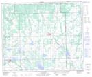
Maps showing St. Walburg, Saskatchewan
St. Walburg is a Town located in Saskatchewan and has an elevation of 638 meters.
- Latitude: 53° 37' 46'' North (decimal: 53.6295639)
- Longitude: 109° 12' 0'' West (decimal: -109.2000310)
- Topography Feature Category: Town
- Geographical Feature: Town
- Canadian Province/Territory: Saskatchewan
- Elevation: 638 meters
- Atlas of Canada Locator Map: St. Walburg
- GPS Coordinate Locator Map: St. Walburg Lat/Long
St. Walburg NTS Map Sheets