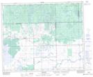
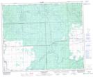
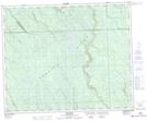
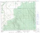
Maps showing Prairie River, 18-44-7-W2, Saskatchewan
Prairie River is a River located in 18-44-7-W2, Saskatchewan and has an elevation of 490 meters.
- Latitude: 52° 47' North (decimal: 52.7833426)
- Longitude: 103° 1' West (decimal: -103.0171444)
- Topography Feature Category: River
- Geographical Feature: River
- Canadian Province/Territory: Saskatchewan
- Elevation: 490 meters
- Location: 18-44-7-W2
- Atlas of Canada Locator Map: Prairie River
- GPS Coordinate Locator Map: Prairie River Lat/Long
Prairie River NTS Map Sheets
063D14 Mistatim Topographic Map at 1:50,000 scale
063D15 Prairie River Topographic Map at 1:50,000 scale
063E02 Fir River Topographic Map at 1:50,000 scale
063E03 Connell Creek Topographic Map at 1:50,000 scale
063D Hudson Bay Topographic Map at 1:250,000 scale
063E Pasquia Hills Topographic Map at 1:250,000 scale
063D15 Prairie River Topographic Map at 1:50,000 scale
063E02 Fir River Topographic Map at 1:50,000 scale
063E03 Connell Creek Topographic Map at 1:50,000 scale
063D Hudson Bay Topographic Map at 1:250,000 scale
063E Pasquia Hills Topographic Map at 1:250,000 scale