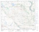
Maps showing Edmunds Coulee, 18-50-26-W3, Saskatchewan
Edmunds Coulee is a Valley located in 18-50-26-W3, Saskatchewan and has an elevation of 602 meters.
- Latitude: 53° 18' North (decimal: 53.3000818)
- Longitude: 109° 50' West (decimal: -109.8341125)
- Topography Feature Category: Valley
- Geographical Feature: Coulee
- Canadian Province/Territory: Saskatchewan
- Elevation: 602 meters
- Location: 18-50-26-W3
- Atlas of Canada Locator Map: Edmunds Coulee
- GPS Coordinate Locator Map: Edmunds Coulee Lat/Long
Edmunds Coulee NTS Map Sheets