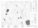
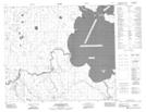
Maps showing Puskwakau River, 64-11-W2, Saskatchewan
Puskwakau River is a River located in 64-11-W2, Saskatchewan and has an elevation of 362 meters.
- Latitude: 54° 33' North (decimal: 54.5500650)
- Longitude: 103° 34' West (decimal: -103.5670751)
- Topography Feature Category: River
- Geographical Feature: River
- Canadian Province/Territory: Saskatchewan
- Elevation: 362 meters
- Location: 64-11-W2
- Atlas of Canada Locator Map: Puskwakau River
- GPS Coordinate Locator Map: Puskwakau River Lat/Long
Puskwakau River NTS Map Sheets