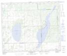
Maps showing Eyinatik Island, Saskatchewan
Eyinatik Island is a Island located in Saskatchewan and has an elevation of 649 meters.
- Latitude: 53° 39' North (decimal: 53.6500918)
- Longitude: 108° 36' West (decimal: -108.6006988)
- Topography Feature Category: Island
- Geographical Feature: Island
- Canadian Province/Territory: Saskatchewan
- Elevation: 649 meters
- Atlas of Canada Locator Map: Eyinatik Island
- GPS Coordinate Locator Map: Eyinatik Island Lat/Long
Eyinatik Island NTS Map Sheets