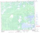
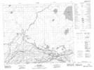
Maps showing South Angling River, 57,58-5,6-W2, Saskatchewan
South Angling River is a River located in 57,58-5,6-W2, Saskatchewan and has an elevation of 264 meters.
- Latitude: 54° 0' North (decimal: 54.0000483)
- Longitude: 102° 42' West (decimal: -102.7004501)
- Topography Feature Category: River
- Geographical Feature: River
- Canadian Province/Territory: Saskatchewan
- Elevation: 264 meters
- Location: 57,58-5,6-W2
- Atlas of Canada Locator Map: South Angling River
- GPS Coordinate Locator Map: South Angling River Lat/Long
South Angling River NTS Map Sheets