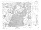
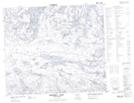
Maps showing Robinson Creek, 66-1-W2, Saskatchewan
Robinson Creek is a River located in 66-1-W2, Saskatchewan.
- Latitude: 54° 45' North (decimal: 54.7500659)
- Longitude: 102° 7' West (decimal: -102.1170633)
- Topography Feature Category: River
- Geographical Feature: Creek
- Canadian Province/Territory: Saskatchewan
- Location: 66-1-W2
- Atlas of Canada Locator Map: Robinson Creek
- GPS Coordinate Locator Map: Robinson Creek Lat/Long
Robinson Creek NTS Map Sheets