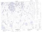
Maps showing Robinson Point, Saskatchewan
Robinson Point is a Cape located in Saskatchewan.
- Latitude: 54° 43' North (decimal: 54.7167293)
- Longitude: 102° 51' West (decimal: -102.8504213)
- Topography Feature Category: Cape
- Geographical Feature: Point
- Canadian Province/Territory: Saskatchewan
- Atlas of Canada Locator Map: Robinson Point
- GPS Coordinate Locator Map: Robinson Point Lat/Long
Robinson Point NTS Map Sheets