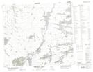
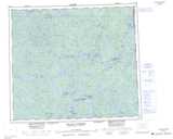
Maps showing Waskuhikun Lake, Saskatchewan
Waskuhikun Lake is a Lake located in Saskatchewan and has an elevation of 305 meters.
- Latitude: 55° 37' North (decimal: 55.6167526)
- Longitude: 102° 18' West (decimal: -102.3003877)
- Topography Feature Category: Lake
- Geographical Feature: Lake
- Canadian Province/Territory: Saskatchewan
- Elevation: 305 meters
- Atlas of Canada Locator Map: Waskuhikun Lake
- GPS Coordinate Locator Map: Waskuhikun Lake Lat/Long
Waskuhikun Lake NTS Map Sheets