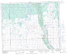
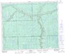
Maps showing Bear Creek, 23-38-2-W2, Saskatchewan
Bear Creek is a River located in 23-38-2-W2, Saskatchewan and has an elevation of 485 meters.
- Latitude: 52° 17' North (decimal: 52.2833274)
- Longitude: 102° 11' West (decimal: -102.1837970)
- Topography Feature Category: River
- Geographical Feature: Creek
- Canadian Province/Territory: Saskatchewan
- Elevation: 485 meters
- Location: 23-38-2-W2
- Atlas of Canada Locator Map: Bear Creek
- GPS Coordinate Locator Map: Bear Creek Lat/Long
Bear Creek NTS Map Sheets