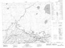
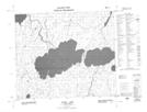
Maps showing Burns Lake, 61-7-W2, Saskatchewan
Burns Lake is a Lake located in 61-7-W2, Saskatchewan and has an elevation of 292 meters.
- Latitude: 54° 15' North (decimal: 54.2500543)
- Longitude: 102° 57' West (decimal: -102.9504374)
- Topography Feature Category: Lake
- Geographical Feature: Lake
- Canadian Province/Territory: Saskatchewan
- Elevation: 292 meters
- Location: 61-7-W2
- Atlas of Canada Locator Map: Burns Lake
- GPS Coordinate Locator Map: Burns Lake Lat/Long
Burns Lake NTS Map Sheets