Maps showing Buzzard Coulee, 46-27-W3, Saskatchewan
Buzzard Coulee is a Valley located in 46-27-W3, Saskatchewan and has an elevation of 571 meters.
- Latitude: 52° 59' North (decimal: 52.9834126)
- Longitude: 109° 51' West (decimal: -109.8507676)
- Topography Feature Category: Valley
- Geographical Feature: Coulee
- Canadian Province/Territory: Saskatchewan
- Elevation: 571 meters
- Location: 46-27-W3
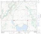
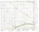
- Atlas of Canada Locator Map: Buzzard Coulee
- GPS Coordinate Locator Map: Buzzard Coulee Lat/Long
Buzzard Coulee NTS Map Sheets