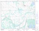
Maps showing McKague, 15-42-14-W2, Saskatchewan
McKague is a Unincorporated area located in 15-42-14-W2, Saskatchewan and has an elevation of 519 meters.
- Latitude: 52° 37' North (decimal: 52.6166694)
- Longitude: 103° 56' West (decimal: -103.9338176)
- Topography Feature Category: Unincorporated area
- Geographical Feature: Hamlet
- Canadian Province/Territory: Saskatchewan
- Elevation: 519 meters
- Location: 15-42-14-W2
- Atlas of Canada Locator Map: McKague
- GPS Coordinate Locator Map: McKague Lat/Long
McKague NTS Map Sheets