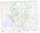
Maps showing Meota, 8-47-17-W3, Saskatchewan
Meota is a Village located in 8-47-17-W3, Saskatchewan and has an elevation of 537 meters.
- Latitude: 53° 2' 16'' North (decimal: 53.0378972)
- Longitude: 108° 27' 36'' West (decimal: -108.4601083)
- Topography Feature Category: Village
- Geographical Feature: Village
- Canadian Province/Territory: Saskatchewan
- Elevation: 537 meters
- Location: 8-47-17-W3
- Atlas of Canada Locator Map: Meota
- GPS Coordinate Locator Map: Meota Lat/Long
Meota NTS Map Sheets