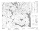
Maps showing Merritt Lake, 67-12-W2, Saskatchewan
Merritt Lake is a Lake located in 67-12-W2, Saskatchewan and has an elevation of 335 meters.
- Latitude: 54° 48' North (decimal: 54.8000672)
- Longitude: 103° 50' West (decimal: -103.8337380)
- Topography Feature Category: Lake
- Geographical Feature: Lake
- Canadian Province/Territory: Saskatchewan
- Elevation: 335 meters
- Location: 67-12-W2
- Atlas of Canada Locator Map: Merritt Lake
- GPS Coordinate Locator Map: Merritt Lake Lat/Long
Merritt Lake NTS Map Sheets