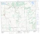
Maps showing Minnehaha, 34-49-18-W3, Saskatchewan
Minnehaha is a Unincorporated area located in 34-49-18-W3, Saskatchewan and has an elevation of 588 meters.
- Latitude: 53° 17' North (decimal: 53.2834181)
- Longitude: 108° 33' West (decimal: -108.5506899)
- Topography Feature Category: Unincorporated area
- Geographical Feature: Locality
- Canadian Province/Territory: Saskatchewan
- Elevation: 588 meters
- Location: 34-49-18-W3
- Atlas of Canada Locator Map: Minnehaha
- GPS Coordinate Locator Map: Minnehaha Lat/Long
Minnehaha NTS Map Sheets