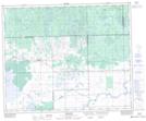
Maps showing Mistatim, 15-45-10-W2, Saskatchewan
Mistatim is a Village located in 15-45-10-W2, Saskatchewan and has an elevation of 483 meters.
- Latitude: 52° 52' 19'' North (decimal: 52.8718750)
- Longitude: 103° 21' 56'' West (decimal: -103.3655333)
- Topography Feature Category: Village
- Geographical Feature: Village
- Canadian Province/Territory: Saskatchewan
- Elevation: 483 meters
- Location: 15-45-10-W2
- Atlas of Canada Locator Map: Mistatim
- GPS Coordinate Locator Map: Mistatim Lat/Long
Mistatim NTS Map Sheets