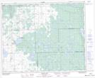
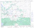
Maps showing Mud Creek, 30-41-9-W2, Saskatchewan
Mud Creek is a River located in 30-41-9-W2, Saskatchewan and has an elevation of 501 meters.
- Latitude: 52° 34' North (decimal: 52.5666655)
- Longitude: 103° 17' West (decimal: -103.2838088)
- Topography Feature Category: River
- Geographical Feature: Creek
- Canadian Province/Territory: Saskatchewan
- Elevation: 501 meters
- Location: 30-41-9-W2
- Atlas of Canada Locator Map: Mud Creek
- GPS Coordinate Locator Map: Mud Creek Lat/Long
Mud Creek NTS Map Sheets