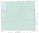
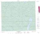
Maps showing Neath Creek, 73-1-W4, Saskatchewan
Neath Creek is a River located in 73-1-W4, Saskatchewan and has an elevation of 669 meters.
- Latitude: 55° 20' North (decimal: 55.3334317)
- Longitude: 110° 1' West (decimal: -110.0175248)
- Topography Feature Category: River
- Geographical Feature: Creek
- Canadian Province/Territory: Saskatchewan
- Elevation: 669 meters
- Location: 73-1-W4
- Atlas of Canada Locator Map: Neath Creek
- GPS Coordinate Locator Map: Neath Creek Lat/Long
Neath Creek NTS Map Sheets