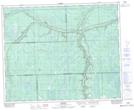
Maps showing Tall Pines, 15-39-5-W2, Saskatchewan
Tall Pines is a Unincorporated area located in 15-39-5-W2, Saskatchewan and has an elevation of 523 meters.
- Latitude: 52° 21' North (decimal: 52.3499918)
- Longitude: 102° 39' West (decimal: -102.6504766)
- Topography Feature Category: Unincorporated area
- Geographical Feature: Railway Point
- Canadian Province/Territory: Saskatchewan
- Elevation: 523 meters
- Location: 15-39-5-W2
- Atlas of Canada Locator Map: Tall Pines
- GPS Coordinate Locator Map: Tall Pines Lat/Long