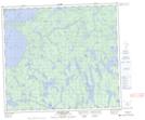
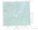
Maps showing Ogloff Bay, Saskatchewan
Ogloff Bay is a Bay located in Saskatchewan and has an elevation of 374 meters.
- Latitude: 56° 20' North (decimal: 56.3334256)
- Longitude: 102° 49' West (decimal: -102.8170464)
- Topography Feature Category: Bay
- Geographical Feature: Bay
- Canadian Province/Territory: Saskatchewan
- Elevation: 374 meters
- Atlas of Canada Locator Map: Ogloff Bay
- GPS Coordinate Locator Map: Ogloff Bay Lat/Long
Ogloff Bay NTS Map Sheets