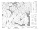
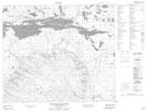
Maps showing Oskikebuk River, 67-13-W2, Saskatchewan
Oskikebuk River is a River located in 67-13-W2, Saskatchewan and has an elevation of 361 meters.
- Latitude: 54° 51' North (decimal: 54.8500677)
- Longitude: 103° 52' West (decimal: -103.8670725)
- Topography Feature Category: River
- Geographical Feature: River
- Canadian Province/Territory: Saskatchewan
- Elevation: 361 meters
- Location: 67-13-W2
- Atlas of Canada Locator Map: Oskikebuk River
- GPS Coordinate Locator Map: Oskikebuk River Lat/Long
Oskikebuk River NTS Map Sheets