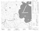
Maps showing Williams Island, Saskatchewan
Williams Island is a Island located in Saskatchewan and has an elevation of 331 meters.
- Latitude: 54° 34' 30'' North (decimal: 54.5750650)
- Longitude: 103° 33' 28'' West (decimal: -103.5579083)
- Topography Feature Category: Island
- Geographical Feature: Island
- Canadian Province/Territory: Saskatchewan
- Elevation: 331 meters
- Atlas of Canada Locator Map: Williams Island
- GPS Coordinate Locator Map: Williams Island Lat/Long
Williams Island NTS Map Sheets