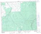
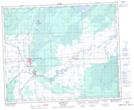
Maps showing Willow Creek, 18-45-1-W2, Saskatchewan
Willow Creek is a River located in 18-45-1-W2, Saskatchewan and has an elevation of 339 meters.
- Latitude: 52° 53' North (decimal: 52.8833536)
- Longitude: 102° 9' West (decimal: -102.1504749)
- Topography Feature Category: River
- Geographical Feature: Creek
- Canadian Province/Territory: Saskatchewan
- Elevation: 339 meters
- Location: 18-45-1-W2
- Atlas of Canada Locator Map: Willow Creek
- GPS Coordinate Locator Map: Willow Creek Lat/Long
Willow Creek NTS Map Sheets