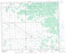
Maps showing Stove Creek, 18-37-8-W2, Saskatchewan
Stove Creek is a Unincorporated area located in 18-37-8-W2, Saskatchewan and has an elevation of 616 meters.
- Latitude: 52° 11' North (decimal: 52.1833247)
- Longitude: 103° 8' West (decimal: -103.1338199)
- Topography Feature Category: Unincorporated area
- Geographical Feature: Locality
- Canadian Province/Territory: Saskatchewan
- Elevation: 616 meters
- Location: 18-37-8-W2
- Atlas of Canada Locator Map: Stove Creek
- GPS Coordinate Locator Map: Stove Creek Lat/Long