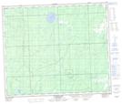
Maps showing Thunderchild Indian Reserve 115D, Saskatchewan
Thunderchild Indian Reserve 115D is a Indian Reserve located in Saskatchewan.
- Latitude: 53° 48' 20'' North (decimal: 53.8056432)
- Longitude: 108° 11' 32'' West (decimal: -108.1923377)
- Topography Feature Category: Indian Reserve
- Geographical Feature: Indian Reserve
- Canadian Province/Territory: Saskatchewan
- GPS Coordinate Locator Map: Thunderchild Indian Reserve 115D Lat/Long
Thunderchild Indian Reserve 115D NTS Map Sheets