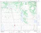
Maps showing Archerwill, 18-40-13-W2, Saskatchewan
Archerwill is a Village located in 18-40-13-W2, Saskatchewan and has an elevation of 548 meters.
- Latitude: 52° 26' 20'' North (decimal: 52.4389943)
- Longitude: 103° 51' 40'' West (decimal: -103.8610139)
- Topography Feature Category: Village
- Geographical Feature: Village
- Canadian Province/Territory: Saskatchewan
- Elevation: 548 meters
- Location: 18-40-13-W2
- Atlas of Canada Locator Map: Archerwill
- GPS Coordinate Locator Map: Archerwill Lat/Long
Archerwill NTS Map Sheets