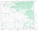
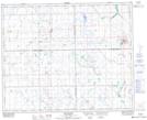
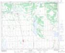
Maps showing Duck Creek, 17-38-12-W2, Saskatchewan
Duck Creek is a River located in 17-38-12-W2, Saskatchewan and has an elevation of 538 meters.
- Latitude: 52° 16' North (decimal: 52.2666644)
- Longitude: 103° 41' West (decimal: -103.6838307)
- Topography Feature Category: River
- Geographical Feature: Creek
- Canadian Province/Territory: Saskatchewan
- Elevation: 538 meters
- Location: 17-38-12-W2
- Atlas of Canada Locator Map: Duck Creek
- GPS Coordinate Locator Map: Duck Creek Lat/Long
Duck Creek NTS Map Sheets