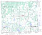
Maps showing Paradise Hill, 52-24-W3, Saskatchewan
Paradise Hill is a Village located in 52-24-W3, Saskatchewan and has an elevation of 566 meters.
- Latitude: 53° 32' 27'' North (decimal: 53.5408832)
- Longitude: 109° 27' 31'' West (decimal: -109.4586388)
- Topography Feature Category: Village
- Geographical Feature: Village
- Canadian Province/Territory: Saskatchewan
- Elevation: 566 meters
- Location: 52-24-W3
- Atlas of Canada Locator Map: Paradise Hill
- GPS Coordinate Locator Map: Paradise Hill Lat/Long
Paradise Hill NTS Map Sheets