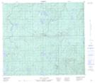
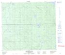
Maps showing Briant Creek, 78-26-W3, Saskatchewan
Briant Creek is a River located in 78-26-W3, Saskatchewan and has an elevation of 548 meters.
- Latitude: 55° 43' North (decimal: 55.7167709)
- Longitude: 109° 58' West (decimal: -109.9675112)
- Topography Feature Category: River
- Geographical Feature: Creek
- Canadian Province/Territory: Saskatchewan
- Elevation: 548 meters
- Location: 78-26-W3
- Atlas of Canada Locator Map: Briant Creek
- GPS Coordinate Locator Map: Briant Creek Lat/Long
Briant Creek NTS Map Sheets