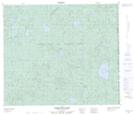
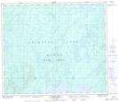
Maps showing Victor Creek, 71-25-W3, Saskatchewan
Victor Creek is a River located in 71-25-W3, Saskatchewan and has an elevation of 676 meters.
- Latitude: 55° 10' North (decimal: 55.1667606)
- Longitude: 109° 46' West (decimal: -109.7675101)
- Topography Feature Category: River
- Geographical Feature: Creek
- Canadian Province/Territory: Saskatchewan
- Elevation: 676 meters
- Location: 71-25-W3
- Atlas of Canada Locator Map: Victor Creek
- GPS Coordinate Locator Map: Victor Creek Lat/Long
Victor Creek NTS Map Sheets