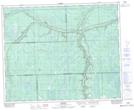
Maps showing Arnfield Lake, 39-6-W2, Saskatchewan
Arnfield Lake is a Lake located in 39-6-W2, Saskatchewan and has an elevation of 562 meters.
- Latitude: 52° 20' North (decimal: 52.3333256)
- Longitude: 102° 44' West (decimal: -102.7338100)
- Topography Feature Category: Lake
- Geographical Feature: Lake
- Canadian Province/Territory: Saskatchewan
- Elevation: 562 meters
- Location: 39-6-W2
- Atlas of Canada Locator Map: Arnfield Lake
- GPS Coordinate Locator Map: Arnfield Lake Lat/Long