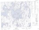
Maps showing Deschambault Lake, 68-9-W2, Saskatchewan
Deschambault Lake is a Unincorporated area located in 68-9-W2, Saskatchewan and has an elevation of 331 meters.
- Latitude: 54° 55' North (decimal: 54.9167352)
- Longitude: 103° 22' West (decimal: -103.3670705)
- Topography Feature Category: Unincorporated area
- Geographical Feature: Hamlet
- Canadian Province/Territory: Saskatchewan
- Elevation: 331 meters
- Location: 68-9-W2
- Atlas of Canada Locator Map: Deschambault Lake
- GPS Coordinate Locator Map: Deschambault Lake Lat/Long
Deschambault Lake NTS Map Sheets