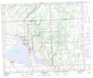
Maps showing The Battlefords Provincial Park, 47,48-17-W3, Saskatchewan
The Battlefords Provincial Park is a Conservation area located in 47,48-17-W3, Saskatchewan and has an elevation of 558 meters.
- Latitude: 53° 7' 3'' North (decimal: 53.1176246)
- Longitude: 108° 22' 27'' West (decimal: -108.3742683)
- Topography Feature Category: Conservation area
- Geographical Feature: Provincial Park
- Canadian Province/Territory: Saskatchewan
- Elevation: 558 meters
- Location: 47,48-17-W3
- Atlas of Canada Locator Map: The Battlefords Provincial Park
- GPS Coordinate Locator Map: The Battlefords Provincial Park Lat/Long
The Battlefords Provincial Park NTS Map Sheets