Canada Topographic Maps

Crystal Creek Topo Maps

Topography maps and Latitude/Longitude Location

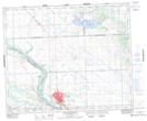
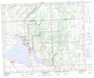
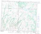
Maps showing Crystal Creek, 47-16-W3, Saskatchewan

Crystal Creek is a River located in 47-16-W3, Saskatchewan and has an elevation of 548 meters.

  • Latitude: 53° 1' North   (decimal: 53.0167432)
  • Longitude: 108° 18' West   (decimal: -108.3006728)
  • Topography Feature Category: River
  • Geographical Feature: Creek
  • Canadian Province/Territory: Saskatchewan
  • Elevation: 548 meters
  • Location: 47-16-W3
  • Atlas of Canada Locator Map: Crystal Creek
  • GPS Coordinate Locator Map: Crystal Creek Lat/Long

Crystal Creek NTS Map Sheets

073C16 North Battleford Topographic Map at 1:50,000 scale

073F01 Jackfish Lake Topographic Map at 1:50,000 scale

073G04 Meeting Lake Topographic Map at 1:50,000 scale

073C North Battleford Topographic Map at 1:250,000 scale

073F St Walburg Topographic Map at 1:250,000 scale

073G Shellbrook Topographic Map at 1:250,000 scale

 
Buy Topographic Maps DVD
Newsletter Sign-up

Yes, I want to receive map store discounts.


Bookmark and Share