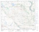
Maps showing Sandy Beach Lake Regional Park, Saskatchewan
Sandy Beach Lake Regional Park is a Conservation area located in Saskatchewan and has an elevation of 580 meters.
- Latitude: 53° 27' 0'' North (decimal: 53.4500836)
- Longitude: 109° 59' 33'' West (decimal: -109.9924536)
- Topography Feature Category: Conservation area
- Geographical Feature: Regional Park
- Canadian Province/Territory: Saskatchewan
- Elevation: 580 meters
- Atlas of Canada Locator Map: Sandy Beach Lake Regional Park
- GPS Coordinate Locator Map: Sandy Beach Lake Regional Park Lat/Long
Sandy Beach Lake Regional Park NTS Map Sheets