Maps showing Little Loon Lake Regional Park, 50-16-W3, Saskatchewan
Little Loon Lake Regional Park is a Conservation area located in 50-16-W3, Saskatchewan and has an elevation of 701 meters.
- Latitude: 53° 21' 20'' North (decimal: 53.3556389)
- Longitude: 108° 15' 22'' West (decimal: -108.2562251)
- Topography Feature Category: Conservation area
- Geographical Feature: Regional Park
- Canadian Province/Territory: Saskatchewan
- Elevation: 701 meters
- Location: 50-16-W3
- Atlas of Canada Locator Map: Little Loon Lake Regional Park
- GPS Coordinate Locator Map: Little Loon Lake Regional Park Lat/Long
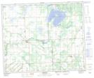
Little Loon Lake Regional Park NTS Map Sheets