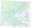
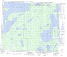
Maps showing Barrier Lake, 57-30-W, Saskatchewan
Barrier Lake is a Lake located in 57-30-W, Saskatchewan and has an elevation of 270 meters.
- Latitude: 53° 54' North (decimal: 53.9000476)
- Longitude: 101° 47' West (decimal: -101.7837500)
- Topography Feature Category: Lake
- Geographical Feature: Lake
- Canadian Province/Territory: Saskatchewan
- Elevation: 270 meters
- Location: 57-30-W
- Atlas of Canada Locator Map: Barrier Lake
- GPS Coordinate Locator Map: Barrier Lake Lat/Long
Barrier Lake NTS Map Sheets