Maps showing Round Hill No. 467, Saskatchewan
Round Hill No. 467 is a Other municipal/district area - miscellaneous located in Saskatchewan.
- Latitude: 53° 4' 28'' North (decimal: 53.0743213)
- Longitude: 108° 0' 9'' West (decimal: -108.0024377)
- Topography Feature Category: Other municipal/district area - miscellaneous
- Geographical Feature: Rural Municipality
- Canadian Province/Territory: Saskatchewan
- Atlas of Canada Locator Map: Round Hill No. 467
- GPS Coordinate Locator Map: Round Hill No. 467 Lat/Long
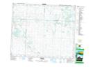
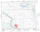
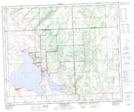
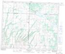
Round Hill No. 467 NTS Map Sheets
073B13 Mayfair Topographic Map at 1:50,000 scale
073C16 North Battleford Topographic Map at 1:50,000 scale
073F01 Jackfish Lake Topographic Map at 1:50,000 scale
073G04 Meeting Lake Topographic Map at 1:50,000 scale
073B Saskatoon Topographic Map at 1:250,000 scale
073C North Battleford Topographic Map at 1:250,000 scale
073F St Walburg Topographic Map at 1:250,000 scale
073G Shellbrook Topographic Map at 1:250,000 scale