Canada Topographic Maps

Battle Creek Topo Maps

Topography maps and Latitude/Longitude Location

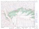
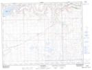
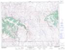
Maps showing Battle Creek, 4-1-26-W3, Saskatchewan

Battle Creek is a River located in 4-1-26-W3, Saskatchewan and has an elevation of 896 meters.

  • Latitude: 49° 5' North   (decimal: 49.0000088)
  • Longitude: 109° 25' West   (decimal: -109.4173941)
  • Topography Feature Category: River
  • Geographical Feature: Creek
  • Canadian Province/Territory: Saskatchewan
  • Elevation: 896 meters
  • Location: 4-1-26-W3
  • Atlas of Canada Locator Map: Battle Creek
  • GPS Coordinate Locator Map: Battle Creek Lat/Long

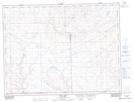
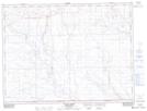
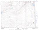
Battle Creek NTS Map Sheets

072E09 Elkwater Lake Topographic Map at 1:50,000 scale

072F03 Lyons Creek Topographic Map at 1:50,000 scale

072F04 Willow Creek Topographic Map at 1:50,000 scale

072F05 Consul Topographic Map at 1:50,000 scale

072F06 Ravenscrag Topographic Map at 1:50,000 scale

072F12 Hungerford Lakes Topographic Map at 1:50,000 scale

072E Foremost Topographic Map at 1:250,000 scale

072F Cypress Lake Topographic Map at 1:250,000 scale

 
Buy Topographic Maps DVD
Newsletter Sign-up

Yes, I want to receive map store discounts.


Bookmark and Share