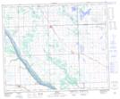
Maps showing Whitemud Creek, 48-18-W3, Saskatchewan
Whitemud Creek is a River located in 48-18-W3, Saskatchewan and has an elevation of 556 meters.
- Latitude: 53° 7' North (decimal: 53.1167474)
- Longitude: 108° 37' West (decimal: -108.6173621)
- Topography Feature Category: River
- Geographical Feature: Creek
- Canadian Province/Territory: Saskatchewan
- Elevation: 556 meters
- Location: 48-18-W3
- Atlas of Canada Locator Map: Whitemud Creek
- GPS Coordinate Locator Map: Whitemud Creek Lat/Long