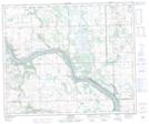
Maps showing Whitesand Creek, 15-51-23-W3, Saskatchewan
Whitesand Creek is a River located in 15-51-23-W3, Saskatchewan and has an elevation of 545 meters.
- Latitude: 53° 24' North (decimal: 53.4000879)
- Longitude: 109° 20' West (decimal: -109.3340764)
- Topography Feature Category: River
- Geographical Feature: Creek
- Canadian Province/Territory: Saskatchewan
- Elevation: 545 meters
- Location: 15-51-23-W3
- Atlas of Canada Locator Map: Whitesand Creek
- GPS Coordinate Locator Map: Whitesand Creek Lat/Long