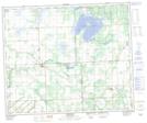
Maps showing Medstead, 11-50-14-W3, Saskatchewan
Medstead is a Village located in 11-50-14-W3, Saskatchewan and has an elevation of 688 meters.
- Latitude: 53° 17' 55'' North (decimal: 53.2985167)
- Longitude: 108° 4' 47'' West (decimal: -108.0796333)
- Topography Feature Category: Village
- Geographical Feature: Village
- Canadian Province/Territory: Saskatchewan
- Elevation: 688 meters
- Location: 11-50-14-W3
- Atlas of Canada Locator Map: Medstead
- GPS Coordinate Locator Map: Medstead Lat/Long
Medstead NTS Map Sheets