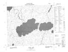
Maps showing Scheelhaase Island Wildlife Refuge, Saskatchewan
Scheelhaase Island Wildlife Refuge is a Conservation area located in Saskatchewan.
- Latitude: 54° 21' North (decimal: 54.3500546)
- Longitude: 102° 49' West (decimal: -102.8171031)
- Topography Feature Category: Conservation area
- Geographical Feature: Wildlife Refuge
- Canadian Province/Territory: Saskatchewan
- Atlas of Canada Locator Map: Scheelhaase Island Wildlife Refuge
- GPS Coordinate Locator Map: Scheelhaase Island Wildlife Refuge Lat/Long
Scheelhaase Island Wildlife Refuge NTS Map Sheets